High Quality Content by WIKIPEDIA articles! NC 400 is the shortest primary state highway in North Carolina. It is 0.93 miles (1.50 km) long and is entirely within the town of Manteo, North Carolina on Roanoke Island. The route traverses from its western terminus at U.S. Route 64 to the Elizabeth II vessel (State Historic Site) docked on Ice Plant Island, located in Shallowbag Bay. Unlike other state routes, all of the NC 400 markers have brown recreational backgrounds. The route is split among two one-way streets: eastbound and westbound.
High Quality Content by WIKIPEDIA articles! North Dakota Highway 4 is a short highway in northern North Dakota. It runs from the Canadian border at Highway 5 south to U.S. Route 281. This route was known as Highway 69 until 1997.
High Quality Content by WIKIPEDIA articles! The North Shore consists of many affluent suburbs north of Chicago, Illinois bordering on the shore of Lake Michigan. It is considered the wealthiest and the most highly educated area in the Midwest.
High Quality Content by WIKIPEDIA articles! North Carolina Highway 615 is a primary state highway in the U.S. state of North Carolina. It runs from the Knotts Island Ferry Terminal, in Knotts Island, to the Virginia state line, near Virginia Beach, Virginia.
High Quality Content by WIKIPEDIA articles! NC 801 is a north–south state highway in the U.S. state of North Carolina that traverses three counties in the central Piedmont region of the state. It is mainly a rural route, linking small towns and communities like Bermuda Run, Hillsdale, North Carolina, Advance, Cooleemee, and eastern Mooresville. It is two-lanes for its entire length, with the exception of a concurrency with U.S. Highway 70 between Cleveland and Salisbury.
High Quality Content by WIKIPEDIA articles! NC 33 is a moderately lengthy state highway in the U.S. state of North Carolina. Spanning a distance of 107 miles (172 km), the east–west route passes through many small towns and communities in Eastern North Carolina`s Inner Banks. It bypasses a large portion of the cities of Greenville and Rocky Mount, and goes through central Tarboro.
High Quality Content by WIKIPEDIA articles! North Dakota Highway 3 is a major north–south highway in North Dakota. It runs from Manitoba Highway 10 at the International Peace Garden to South Dakota Highway 45 south of Ashley.
High Quality Content by WIKIPEDIA articles! North Carolina Highway 160 is a primary state highway in the state of North Carolina. The highway runs north–south, connecting the Steele Creek neighborhood, Charlotte/Douglas International Airport, and Uptown Charlotte.
High Quality Content by WIKIPEDIA articles! NC 561 is a 101-mile (163 km) North Carolina state highway and a rural traffic artery connecting Louisburg and Ahoskie with many small-to-medium sized towns in the "Down East" and Coastal Plain regions within minutes from the Virginia state line. NC 561 is a spur of NC 56, although the two highways never actually intersect.
High Quality Content by WIKIPEDIA articles! NC 268 is an 86-mile (138 km) North Carolina state highway. It connects manny communities as it traverses through the northwestern North Carolina mountains and foothills.
High Quality Content by WIKIPEDIA articles! The North Pennine Ring is a canal ring which crosses the Pennines between Manchester, Leeds and Castleford. It follows parts of five canals, and shares much of its route with the Outer Pennine Ring, which uses a different route for the southern crossing of the Pennines.
High Quality Content by WIKIPEDIA articles! North Carolina Highway 147 is a North Carolina state highway assigned to the Durham Freeway. It lies entirely within Durham County, and has the additional titles East–West Expressway, Buck Dean Expressway, and Triangle Parkway on various segments.
High Quality Content by WIKIPEDIA articles! North Carolina Highway 20 (NC 20) is a 27-mile (43 km) North Carolina state highway that runs through Bladen, Robeson and Hoke counties. It serves as a major road in each of the three incorporated communities it passes through. The route is co-designated as St. Pauls Road in Raeford, Main Street in Lumber Bridge, and Broad Street in St. Pauls.
High Quality Content by WIKIPEDIA articles! The North East Link is a freeway planned for Melbourne`s north eastern suburbs by the State government of Victoria as part of the Victorian Transport Plan and estimated to cost over A$6 billion. It was first proposed in the 1969 Melbourne Transport Plan, and is designed to provide a road connection between the Metropolitan Ring Road in Greensborough and the Eastern Freeway in Bulleen.
High Quality Content by WIKIPEDIA articles! NC 136 is a 2.2-mile (3.5 km) North Carolina state highway that runs entirely within Currituck County. It is a short spur of US 158, connecting the U.S. Highway to the small unincorporated community of Poplar Branch. The route`s eastern terminus is at a boat launch on the Currituck Sound. Prior to 2002, NC 136`s current alignment was NC 3. The two routes swapped designations in 2002 to put NC 3 near the home of Dale Earnhardt, a deceased NASCAR driver from Kannapolis that drove the #3 car.
High Quality Content by WIKIPEDIA articles! North Carolina Highway 522 is a primary state highway in the state of North Carolina. The highway runs north–south from the South Carolina state line, near Sapps Crossroads, to North Carolina Highway 200, in Roughedge.
High Quality Content by WIKIPEDIA articles! Northbrook is a village located at the northern edge of Cook County, Illinois, which is also a North Shore suburb of Chicago. The population was 33,170 at the 2010 census.
High Quality Content by WIKIPEDIA articles! The City of North Vancouver is a waterfront municipality on the north shore of Burrard Inlet, directly across from Vancouver, British Columbia. It is the smallest of the three North Shore municipalities, and the most urbanized as well. Although it has significant industry of its own, including shipping, chemical production, and film production, the City is usually considered to be a suburb of Vancouver. The city is served by the Royal Canadian Mounted Police, British Columbia Ambulance Service, and the North Vancouver City Fire Department.
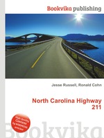
High Quality Content by WIKIPEDIA articles! NC 211 is a 155-mile (249 km) North Carolina state highway that travels mostly through the Sandhills and Coastal Plain regions of the state. The southern segment of NC 211 provides access across the Green Swamp to the Brunswick County beaches. This segment may be used for the Future Interstate 74 freeway alignment through the region. The highway is signed in an east–west direction between Candor and Red Springs; from Red Springs towards Southport it is signed in a north–south direction.
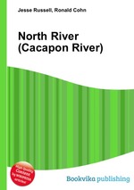
High Quality Content by WIKIPEDIA articles! North River is a tributary of the Cacapon River, belonging to the Potomac River and Chesapeake Bay watersheds. The river is located in Hampshire and Hardy counties in the U.S. state of West Virginia`s Eastern Panhandle. The mouth of North River into the Cacapon is located at Forks of Cacapon. From its headwaters to its mouth, the North River spans 52.4 miles (84.3 km) in length.
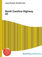
High Quality Content by WIKIPEDIA articles! NC 55 is a 192-mile (309 km) North Carolina state highway that serves as a traffic artery connecting Durham to numerous small cities and towns in the The Triangle on its way toward the Pamlico Sound. A portion of NC 55 extends through Research Triangle Park. NC 55 is a major artery in the central part of The Triangle region, and is a four lane, divided highway between Durham and Cary and Apex. NC 55 is also a divided highway between Apex and Fuquay-Varina.
High Quality Content by WIKIPEDIA articles! North Carolina Highway 110 is a state route in Haywood County in western North Carolina, USA. The route serves to connect the rural communities of Cruso, Woodrow, and Bethel with the town of Canton.
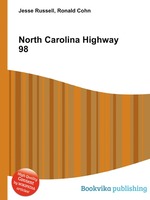
High Quality Content by WIKIPEDIA articles! NC 98 is a 45-mile (72 km) North Carolina state highway and a semi-urban traffic artery connecting Durham to Wake Forest as well as many small-to-medium sized towns in the north portion of The Triangle region. A bypass was recently completed around Wake Forest to the south, which made the old route passing through town become NC 98 Business.