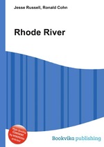
High Quality Content by WIKIPEDIA articles! The Rhode River is a 3-mile-long (5 km)tidal tributary of the West River in Anne Arundel County, Maryland. It is south of the South River.
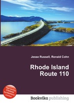
High Quality Content by WIKIPEDIA articles! Route 110 is a numbered State Highway running 7.0 miles (11.3 km) wholly within the town of South Kingstown in Rhode Island. It serves to connect the University of Rhode Island to points south via U.S. 1.
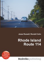
High Quality Content by WIKIPEDIA articles! Route 114 is a numbered State Highway running 45.6 miles (73.4 km) in the U.S. state of Rhode Island. It connects the city of Newport to the city of Woonsocket. Route 114 was a major north–south artery for its entire length until the arrival of the Interstate Highway System. It is still a major commercial corridor on Aquidneck Island and in northern Rhode Island (mainly Central Falls, Cumberland and Woonsocket).
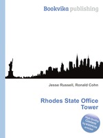
High Quality Content by WIKIPEDIA articles! The James A. Rhodes State Office Tower is a 629-foot (192 m) skyscraper located in Columbus, Ohio. The Rhodes Tower was completed and occupied in 1974, and is currently the tallest building in Columbus and the fifth tallest in Ohio (after the Key Tower, Terminal Tower and 200 Public Square in Cleveland and Great American Tower at Queen City Square in Cincinnati). Currently, approximately 4000 state employees work in the building. Construction costs totaled approximately $66 million. It is named after Ohio`s longest serving governor, James A. Rhodes. The building`s odd shape is attributed to a last-minute decision to cap the buildings height; originally, the building was supposed to be nearly...
High Quality Content by WIKIPEDIA articles! Route 123 is a state highway running 7.7 miles (12.4 km) in the U.S. state of Rhode Island. Route 123 is not a very heavily traveled road as compared to others in the region.
High Quality Content by WIKIPEDIA articles! Route 118 is a numbered state highway in the U.S. state of Rhode Island, running 5.5 miles (8.9 km) along Harkney Hill Road from Route 3 to Route 102 in Coventry, R.I. It is one of the more recent state highways, having been designated and signed ca. 1999.
High Quality Content by WIKIPEDIA articles! Route 10 is a numbered state highway connector in the U.S. state of Rhode Island, running along the Huntington Expressway, the first freeway in the state. It connects Route 12 (Park Avenue) on the Cranston-Providence border with Interstate 95, U.S. Route 6 and Memorial Boulevard in downtown Providence, passing just east of the Olneyville area of Providence. It provides an alternate route to I-95 south of downtown, and connects it with the US 6 freeway west from Olneyville towards Interstate 295 and Connecticut.
High Quality Content by WIKIPEDIA articles! Route 107 is a numbered State Highway running 3.5 miles (5.6 km) in Rhode Island, United States. The route serves the town of Burrillville and connects Route 100 with Route 102.
High Quality Content by WIKIPEDIA articles! Route 113 is a numbered State Highway running 3.4 miles (5.5 km) in Rhode Island. The route connects Route 2 and Route 117 in the city of Warwick.
High Quality Content by WIKIPEDIA articles! Route 103A is a numbered State Highway running 1.7 miles (2.7 km) in Rhode Island. It serves the Riverside section of East Providence.
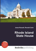
High Quality Content by WIKIPEDIA articles! The Rhode Island State House is the capitol of the U.S. state of Rhode Island. It is located on the border of the Downtown and Smith Hill sections of the state capital city of Providence. The State House is a neoclassical building that houses the Rhode Island General Assembly and the offices of the governor of Rhode Island as well as the lieutenant governor, secretary of state, and General Treasurer of Rhode Island. The building is on the National Register of Historic Places.