High Quality Content by WIKIPEDIA articles! State Highway 82, abbreviated to SH-82 or OK-82, is a state highway in Oklahoma. It runs for 49.4 miles(79.5 km) north–south during its southern segment; and 99.5 miles (160.13 km) north–south during its northern segment.
High Quality Content by WIKIPEDIA articles! State Highway 167 is a state highway near Tulsa, Oklahoma. Having only a length of less than 5 miles (7.8 km), it only passes through Rogers Co.. SH-167 connects Interstate 44/US 412/SH-66 at Catoosa to the Tulsa Port of Catoosa on the McClellan-Kerr Navigation System (part of the Arkansas River), and to serve truck traffic traveling to the port. It is the last free exit heading eastbound on I-44 before the Will Rogers Turnpike begins.
High Quality Content by WIKIPEDIA articles! State Highway 10 (abbreviated SH-10 or OK-10) is a state highway in northeastern Oklahoma. It makes a 235.5 mile (379 km) crescent through the northeast corner of the state, running from State Highway 99 in Osage County to Interstate 40 near Gore. It has two lettered spur routes.
High Quality Content by WIKIPEDIA articles! State Highway 44 (abbreviated SH-44 or OK-44) is a state highway in the western portion of the U.S. state of Oklahoma. It runs for 59.5 miles (95.8 km) from near Blair in Greer Co. to Butler in Custer Co. It is not to be confused with Interstate 44. The highway has one lettered spur route, SH-44A.
High Quality Content by WIKIPEDIA articles! State Highway 151 (abbreviated SH-151 or OK-151) runs 2.30 miles (3.70 km) miles across Keystone Dam in northeastern Oklahoma. Its entire length is within Tulsa County. The route has no lettered spur routes.
High Quality Content by WIKIPEDIA articles! State Highway 126 was a state highway in McClain County, Oklahoma. It ran from State Highway 76 north of Dibble to State Highway 24 in Washington, paralleling State Highway 74B. It was given to McClain County in about 1966.
High Quality Content by WIKIPEDIA articles! State Highway 39, abbreviated as SH-39 or OK-39, is a state highway in the U.S. state of Oklahoma. It is 68.4 miles (110 km) in length. Built in 1923, it runs east–west through the central part of the state. It currently has no lettered spurs.
High Quality Content by WIKIPEDIA articles! State Highway 144 (SH-144/OK-144) is a state highway in Oklahoma. It runs 36.6 miles in Pushmataha and LeFlore counties.
High Quality Content by WIKIPEDIA articles! State Highway 22 (SH-22 or OK-22) is a state highway in Oklahoma. It runs in a 47.5-mile (76 km) west-to-east pattern through the south-central part of the state, running from SH-1 at Ravia to US-70 at Bokchito.
High Quality Content by WIKIPEDIA articles! State Highway 251A, also known as SH-251A or OK-251A, is a highway maintained by the U.S. state of Oklahoma. The highway has a length of 5.37 miles (8.64 km) in Wagoner County and 0.69 miles (1.11 km) in Cherokee County, for a total length of 6.06 miles (9.75 km). The highway runs from State Highway 16 in Okay, Oklahoma to State Highway 80 north of Ft. Gibson. It runs across the dam of Fort Gibson Lake.
High Quality Content by WIKIPEDIA articles! Oklahoma`s State Highway 33 (abbreviated SH-33 or OK-33) is a major highway that traverses most of the state, and at one time traversed the entire state. Its general orientation is west to east. All mileages listed herein are from the western terminus of the highway at the Texas state line.
High Quality Content by WIKIPEDIA articles! State Highway 132, also known as SH-132 or OK-132, is a state highway in north-central Oklahoma. It connects State Highway 51 west of Hennessey to the Kansas state line near Manchester, running for 65.3 miles (105.1 km). It has no lettered spur routes.
High Quality Content by WIKIPEDIA articles! State Highway 28 (SH-28 or OK-28) is a state highway in Oklahoma. It runs 68.8 miles in an irregular west-to-east pattern through Nowata, Rogers, Mayes and Delaware counties.
High Quality Content by WIKIPEDIA articles! State Highway 117 is a state highway in northeastern Oklahoma. The majority of the 7.4-mile (11.9 km) highway is in Creek Co. with the easternmost one mile (1.6 km) in Tulsa Co. It is 7.3 miles (12 km) long. SH-117 has one lettered spur in the city of Sapulpa.
High Quality Content by WIKIPEDIA articles! State Highway 199, also known as SH-199 or OK-199, is a 44-mile (71-kilometer) highway in southern Oklahoma. The highway connects Ardmore to Madill as a more northerly alternate to US-70, which much of SH-199 is an old alignment of. It provides access to the Fort Washita Historic Site.
High Quality Content by WIKIPEDIA articles! State Highway 108 is a minor state highway in Payne, Noble, and Pawnee Counties, in North Central Oklahoma. It runs for approximately 24.0 miles (38.6 km). SH-108 has no lettered spurs.
High Quality Content by WIKIPEDIA articles! State Highway 52 (abbreviated SH-52 or OK-52) is a name for two once-connected highways in Oklahoma. There are no lettered spur routes from either of them.
High Quality Content by WIKIPEDIA articles! State Highway 17, abbreviated as SH-17 or OK-17, is an east–west highway in Oklahoma. It is a relatively short highway, extending for only 20.9 miles (33.6 km) from US-277 to Business US-81 in Rush Springs. It has no lettered spur routes.
High Quality Content by WIKIPEDIA articles! State Highway 100 (abbreviated SH-100 or OK-100) is a 54.9-mile (88.4 km) long (88.4 km) state highway in eastern Oklahoma. It connects Interstate 40 with the Arkansas state line near Stilwell. It has no lettered spur routes.
High Quality Content by WIKIPEDIA articles! State Highway 47 (SH-47 or OK-47) is a state highway in Oklahoma. It runs 94.6 miles (152.2 km) west-to-east in Roger Mills, Dewey and Custer counties.
High Quality Content by WIKIPEDIA articles! State Highway 16 (SH-16 or OK-16) is a state highway in Oklahoma. It runs in an irregular 99.2-mile west-to-east pattern through the northeastern part of the state, running from SH-33 at Drumright to SH-51 at Wagoner. There are no letter-suffixed spur highways branching from SH-16.
High Quality Content by WIKIPEDIA articles! State Highway 152 (SH-152 or OK-152) is a state highway running through west-central Oklahoma. At a length of 149.6 miles (240.76 km), it is the longest three-digit state highway in Oklahoma. It runs from State Highway 152 at the Texas State Line to Interstate 44 near Will Rogers World Airport in Oklahoma City. It has no lettered spur routes.
High Quality Content by WIKIPEDIA articles! State Highway 4, abbreviated as SH-4 or OK-4, is a designation for two distinct highways maintained by the U.S. state of Oklahoma. One of them serves as an important route through the suburbs west of Oklahoma City, while the other connects US-259 to the Arkansas state line west of Cove, Arkansas. SH-4 has no lettered spur routes
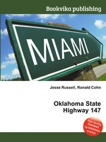
High Quality Content by WIKIPEDIA articles! State Highway 147 (SH-147/OK-147) is a state highway in Oklahoma. It runs 13.6 miles in Choctaw and Pushmataha counties. Highway 147 begins at US-70, just east of Sawyer. From there it runs north, up the east side of Hugo Lake. There is a one-mile (1.6 km) dogleg to the east just south of the community of Spencerville, and another short dogleg east at the Choctaw/Pushmataha county line. SH-147 terminates at SH-3 in Oleta.