High Quality Content by WIKIPEDIA articles! State Highway 100 (abbreviated SH-100 or OK-100) is a 54.9-mile (88.4 km) long (88.4 km) state highway in eastern Oklahoma. It connects Interstate 40 with the Arkansas state line near Stilwell. It has no lettered spur routes.
High Quality Content by WIKIPEDIA articles! State Highway 47 (SH-47 or OK-47) is a state highway in Oklahoma. It runs 94.6 miles (152.2 km) west-to-east in Roger Mills, Dewey and Custer counties.
High Quality Content by WIKIPEDIA articles! State Highway 16 (SH-16 or OK-16) is a state highway in Oklahoma. It runs in an irregular 99.2-mile west-to-east pattern through the northeastern part of the state, running from SH-33 at Drumright to SH-51 at Wagoner. There are no letter-suffixed spur highways branching from SH-16.
High Quality Content by WIKIPEDIA articles! State Highway 152 (SH-152 or OK-152) is a state highway running through west-central Oklahoma. At a length of 149.6 miles (240.76 km), it is the longest three-digit state highway in Oklahoma. It runs from State Highway 152 at the Texas State Line to Interstate 44 near Will Rogers World Airport in Oklahoma City. It has no lettered spur routes.
High Quality Content by WIKIPEDIA articles! State Highway 4, abbreviated as SH-4 or OK-4, is a designation for two distinct highways maintained by the U.S. state of Oklahoma. One of them serves as an important route through the suburbs west of Oklahoma City, while the other connects US-259 to the Arkansas state line west of Cove, Arkansas. SH-4 has no lettered spur routes
High Quality Content by WIKIPEDIA articles! State Highway 147 (SH-147/OK-147) is a state highway in Oklahoma. It runs 13.6 miles in Choctaw and Pushmataha counties. Highway 147 begins at US-70, just east of Sawyer. From there it runs north, up the east side of Hugo Lake. There is a one-mile (1.6 km) dogleg to the east just south of the community of Spencerville, and another short dogleg east at the Choctaw/Pushmataha county line. SH-147 terminates at SH-3 in Oleta.
High Quality Content by WIKIPEDIA articles! State Highway 63 (abbreviated SH-63) is a 96.7 mile (155.6 km)state highway in southeastern Oklahoma. It runs from U.S. Highway 69 in Kiowa to the Arkansas state line. SH-1 forms a concurrency with SH-63 for 37.8 miles (60.8 km), nearly forty percent of the highway`s length. SH-63 has one spur route, designated as SH-63A.
High Quality Content by WIKIPEDIA articles! State Highway 36 (abbreviated SH-36 or OK-36) is a state highway in Oklahoma. It runs for 44.5 mi (71.62 km), forming a western loop route from Interstate 44, which it connects to at both ends. It passes through Cotton Co., Tillman Co., and Comanche Co.. It has no lettered spur routes.
High Quality Content by WIKIPEDIA articles! State Highway 133 (abbreviated SH-133 or OK-133) is a short 6.6-mile (10.6 km) (10.6 km) state highway in central Oklahoma, United States. has no lettered spur routes.
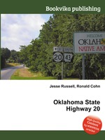
High Quality Content by WIKIPEDIA articles! State Highway 20 (abbreviated SH-20 or OK-20) is a highway in northeastern Oklahoma. Its eastern terminus is at the corner of Oklahoma, Arkansas, and Missouri near Southwest City, Missouri; its western terminus is at State Highway 18 near Ralston. The highway runs a total length of 143.8 miles It has no lettered spur routes.
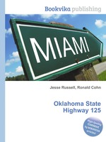
High Quality Content by WIKIPEDIA articles! State Highway 125 is a state highway in northeastern Oklahoma that is 26.3 mi (42.33 km) long. It begins in the south at Grand Lake O` the Cherokees, running northward to meet State Highway 85A six miles (10 km) later. It then crosses U.S. Highway 59 four miles (6 km) later and US-60 near Fairland before ending in Miami at US-69/State Highway 10. It has no lettered spur routes.
High Quality Content by WIKIPEDIA articles! State Highway 32 (SH-32 or OK-32) is a state highway in the U.S. state of Oklahoma. The highway runs from west to east across the southern part of the state, just north of the Red River. The route begins at US-81 in Ryan and ends at US-70 in Kingston, a length of 77.3 miles (124.4 km).
High Quality Content by WIKIPEDIA articles! State Highway 23 (SH-23 or OK-23) is a state highway in Oklahoma. It runs 36.2 miles south-to-north through the center of Beaver County, in the Panhandle, running from the Texas state line to the Kansas state line.
High Quality Content by WIKIPEDIA articles! State Highway 27 (SH-27 or OK-27) is a state highway in Oklahoma. It runs 16 miles south-to-north in Hughes and Okfuskee Counties.
High Quality Content by WIKIPEDIA articles! State Highway 11 (SH-11 or OK-11) is a state highway in Oklahoma. It runs in an irregular west-to-east path 208 miles (334.7 km) across the northern part of the state, from US-281 seven miles (11 km) north of Alva to I-244/US-412 in Tulsa. There is one letter-suffixed spur highway branching from SH-11, SH-11A.
High Quality Content by WIKIPEDIA articles! State Highway 18, abbreviated as SH-18 or OK-18, is a highway maintained by the U.S. state of Oklahoma. It was once one of the longest state highways in the Oklahoma road system, but now has a total length of 134.4 mi (216.3 km).
High Quality Content by WIKIPEDIA articles! State Highway 26 (abbreviated SH-26 or OK-26) is a state highway in Oklahoma. It runs for a total of 7.97 miles (12.83 km), south-to-north, in eastern Haskell County. SH-26 serves as a link between SH-31 and SH-9. There are no letter-suffixed spur highways branching from SH-26.
High Quality Content by WIKIPEDIA articles! State Highway 102 (abbreviated SH-102 or OK-102) is a north–south state highway in central Oklahoma. It runs for 52.9 miles (85.1 km) from Wanette, Oklahoma to Wellston, Oklahoma. It has no lettered spur routes.
High Quality Content by WIKIPEDIA articles! State Highway 86 (abbreviated SH-86 or OK-86) is a minor state highway that connects SH-51 with Perry. The highway is contained wholly in Payne and Noble Counties.
High Quality Content by WIKIPEDIA articles! State Highway 5 (SH-5 or OK-5) is the name assigned to two distinct state highways in the U.S state of Oklahoma. One runs for 21 miles (33.6 km) through extreme southwestern Oklahoma, passing through Harmon and Jackson Counties. The other is 98 miles (158 km) long and runs through southwest Oklahoma, connecting US-283 south of Altus to US-70 at Waurika.
High Quality Content by WIKIPEDIA articles! State Highway 164 (abbreviated SH-164 or OK-164) is a state highway in north-central Oklahoma. It runs from State Highway 74 in Covington to US-77 west of Perry. SH-164 is 12.64 miles (20.34 km) long. It has no lettered spur routes.
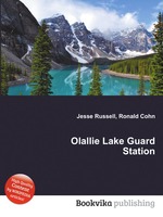
High Quality Content by WIKIPEDIA articles! Olallie Lake Guard Station is a former guard station in Jefferson County in the U.S. state of Oregon. Built in 1939, the cabin is in the Olallie Scenic Area near Olallie Butte and Mount Jefferson in the Cascade Mountains. It was listed on the National Register of Historic Places in 1991.